- Location: East of Talca, Vilches, Parque Alto Los Lircay
- Relevant maps: JLM No. 9 Araucanía, detail map 1:50.000 Huaso Trails
- Access: 2-day hike to base, 1 day to top (ca. 2000m)
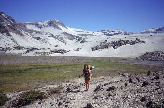
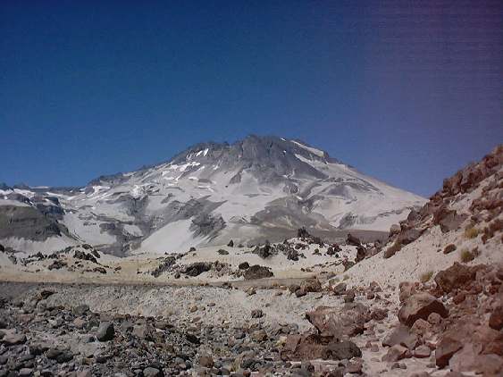
- Characteristics: Easy trail and ascent, moon-like landscape of white volcanic ash, warm springs at base, highly recommended trekking
- Various: Park entrance fee, camping sites available in park, free camping on trail
- Season: Snow in winter, has been done as randonnee.
Download official flyer of National Park folleto_parque.zip (1.1 MB)
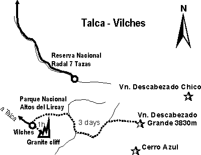
The hike starts in a national reserve, where you can inquire the details. It is a 5-6 day round trip, including the ascent of the volcano. The hike leads you through woods and river valleys to a moon-like, ash-covered landscape within an active volcanic area. Do not miss the warm pools at the base of the volcano. We found it one of the best trekking tours of Chile.